Share the post "Detection of buried networks and georeferencing"
The major issue:
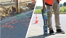
Locate all sensitive buried networks with an accuracy of 10 cm
The new French regulations reinforce the obligation to ensure the safety of the works by the project owner thanks to the precise location of the networks. Thus, all recipient operators of a work request (DT) will be required to transmit network location data so that the work can be carried out in complete safety.
-
-
-
-
-
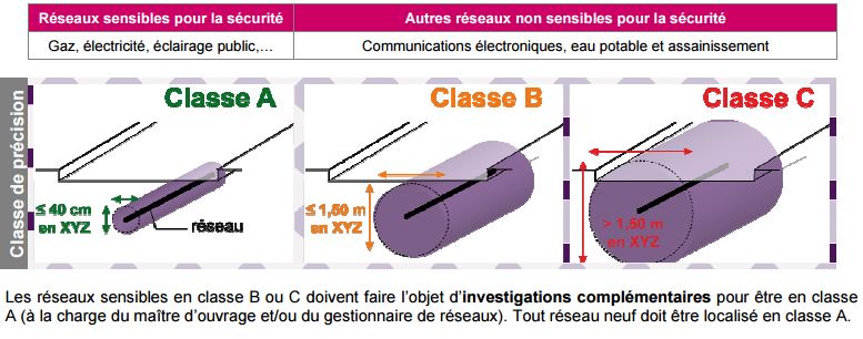
- class A (40 cm, which amounts to taking readings with 10 cm precision),
- class B (between 40 cm and 1.0 m)
- class C (greater than 1.0 m).
-
-
-
-
-
-
-
-
-
- the interruption of work on a site as soon as a dangerous situation is encountered and
- strengthening the skills of machine operators and site managers in the field of work safety near networks, obligations which will be subject to periodic updates and verification.
-
-
-
-
Access the DT-DICT Regulation Application Guide
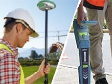
Detection technologies:
-
-
-
-
- Electromagnetic detection of metals, which does not allow very precise localization. Active and passive induction detection. Depending on the frequency range used, it can detect gas, energy, water and sanitation networks. But this technology remains sensitive to electrical interference. The additional addition of a probe makes it possible to detect non-conductive networks up to ten meters deep.
- Detection by acoustic pulse, which is essential especially for the detection and localization of non-conductive materials (cement, PVC).
- Ground radars (or GPR) which are systems that provide an image of the subsoil from the emission of an electromagnetic wave. However, the higher the transmission frequency, the shallower the penetration depth. Also, each GPR is designed for a given frequency. Low frequencies emitted to obtain data at depth will give lower accuracy, and the lower they are, the more they will burden the GPR.
- Technologies based on electronic markers which consist of installing a contactless chip (RFID) in a hermetic casing on existing networks or integrated into the tube for new installations. The process gives great precision and allows the information to be reported directly on a GIS.
-
-
-
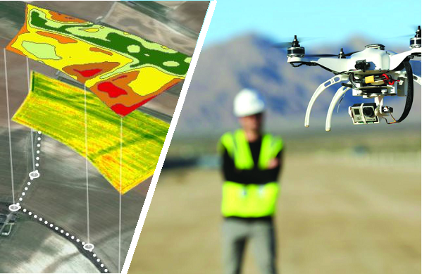
Augmented reality
Augmented reality in the field is gaining precision and stability. Developers are now using a precision GPS connected to their tablet and the RTK signal from the Orpheon network to display a 3D model directly at the place of use or construction at 1:1 scale.
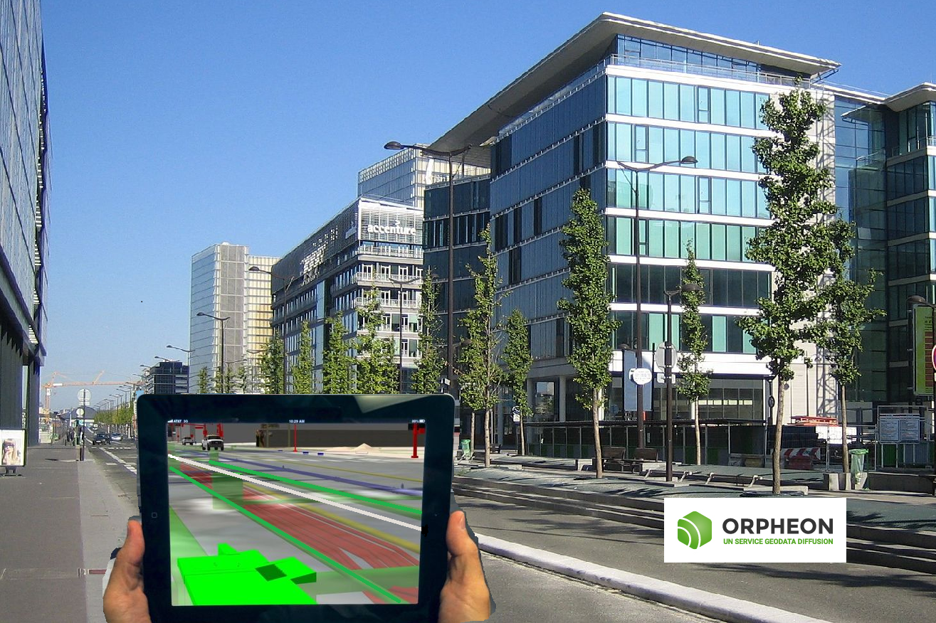
Augmented reality more precise and stable thanks to centimetric corrections
This augmented reality is integrated directly into the images captured by the tablet’s integrated camera, live and allows excellent immersion which multiplies the projection capacity of field professionals or investors by putting them face to face with the various invisible underground elements such as buried networks or projecting their projects into reality. Augmented reality gives them a good overview of the integration of projects within existing architecture or of the constraints of the close environment by showing what is difficult, if not impossible, to move.
In addition, it is possible to interact from the screen on the projected 3D model and to take advantage of many features integrated into these applications, which also offer a wealth of additional information, judicious notes and many other contents that enrich the project.
In industry too, augmented reality is becoming an excellent way to promote a project: factory, production line, products.
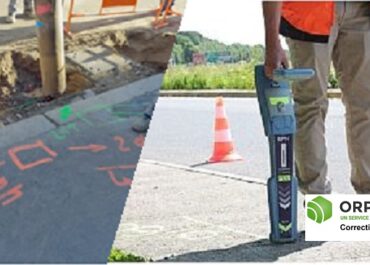
Orpheon brings precision and stability
The centimetric precision provided by the use of a precision GPS associated with the RTK correction signal from the Orpheon network then becomes essential and greatly facilitates the tasks of developers. Objects integrated in augmented reality are thus very quickly and correctly placed in the projected space without oscillation.
A Full GNSS network: one step ahead
Our customers connect to our NRTK real-time corrections services with their GNSS-compatible equipment and take full advantage of the new Galileo and BeiDou corrections in addition to traditional GPS and Glonass. The addition of these very many additional satellites brings more precision and availability even in the most difficult conditions of use.. (voir article 22 Operational Galileo Satellites accessible with the Orpheon network)

Democratization of technology
The arrival of high-performance and rugged tablets or smartphones with increased autonomy, but also the democratization of precision GPS favors the emergence of many projects to which the Orphéon network responds perfectly.
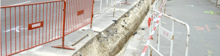
Declaration of work near buried networks (DT DICT)
The work planned near pipelines and buried networks must be declared to their operators, before their execution, by means of the declaration of project of works (DT) by the client, and the declaration of intent to start work (DICT) by the contractor. Any declaration must be preceded by a consultation of the one-stop shop, accessible online, which lists all the networks present in the territory.
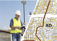
Simplified street plan (PCRS)
A single base plan for work near sensitive underground networks.
The role of topography in a GIS is to serve as a reference and support layer for a large number of application domains. It is an instrument at the service of the management and development of the heritage of communities.
- Its value is based on its ability to be shared and on the multiplicity of uses of each of its actors.
- It is limited to the most useful objects but it in no way sacrifices centimetric precision, which guarantees the accuracy of the information and its subsequent reuse.
- It is defined by accuracy class within the meaning of the 2003 decree and not by a scale of representation.
- It has no business content.
- Study plans and projects may use this base.
- It must meet the objectives of the reform of DT-DICT by allowing dematerialized exchanges during receipts of DT or DICT.
- Its constitution is at the initiative of the community within the framework of pooling between the network managers and the communities. It is maintained by the community.
- It is in line with the recommendations made by the CNIG within the framework of the large-scale reference system in dense urban areas (RGE ZUD).
The PCRS nomenclature describes the apparent boundaries of the road.
- It is a list of objects characterized by their accuracy class which replaces the concept of traditional topographic map:
- The final representation of each object is specific to each application and can refer to a symbol specific to each user, however a default representation will be defined.
- The consistency guarantee is based on the accuracy class to which all survey operations are necessarily attached.
- The attribute data accompanying each object of the PCRS will contain at least the genealogy of its acquisition (date of creation, origin, type, survey or resulting from transformation). Other attribute data may characterize each object (e.g. nature of the boundary: tar, low wall, etc.)
- This nomenclature lists only the necessary and sufficient objects constituting a base.
- Objects are defined in X, Y and Z.
- In this PCRS, there is no data existing elsewhere such as the business data of network operators (flush) or existing data in national databases (single cadastral parcel representation RPCU, national address database BAN). These external data can be viewed using appropriate processing (eg shifting the name of the routes to facilitate reading) and by geo-referencing (RGF93).
The PCRS alone may sometimes prove insufficient for certain operations when more detailed and precise information is required. This is why some municipalities are tempted to go even further in the process, by directly adopting a very large-scale reference system (RTGE), to make it possible to increase the security of interventions on the networks, but also to facilitate the interoperability of data between structures.