Masks and multipaths
In wooded areas or bordered by buildings, some satellites may be obscured and therefore unusable by the equipment on the ground to establish a correct position. It is also possible that these signals come from the reflections of a body of water, glass or metal surfaces, mountains, trees or constructions creating multipaths which alters the precision of the positioning.
Masks and multipaths
GPS / GNSS Positioning Accuracy Limits
Several natural errors affect the satellite/receiver distance measurement:
-
-
-
- The electronics bias of the satellite
- The effect of orbit error.
- The Effect of Satellite Clock Error.
- The satellite antenna phase center position error.
- Ionospheric elongation.
- Tropospheric elongation.
- Possible multi-paths.
- The position error of the phase center of the antenna of the mobile receiver.
- The Effect of Receiver Clock Error.
- Receiver Electronics Bias.
-
-
Of all these sources of error, atmospheric refraction, responsible for ionospheric and tropospheric elongation, and orbital errors are the most problematic, as:
- they cannot be finely modeled beforehand (unlike electronic biases or antenna phase center variations),
- they cannot completely cancel each other out by multiple differentiations.
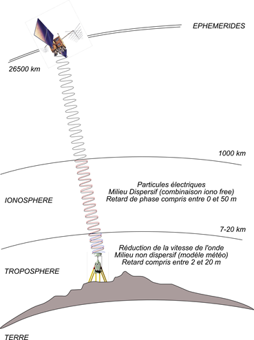
Errors affecting positioning accuracy by GPS / GNSS methods are related to:
Origin of these errors :
| Source d’erreur | Influence absolue |
| Orbites | Entre 2 et 50 mètres |
| Ionosphère | Entre 50cm et plus de 100 mètres |
| Troposphère | Entre 1 et 50 cm |
To determine the position, the GPS receiver calculates the distance at which the satellites are at the same time from the data of their ephemerides and based on its internal clock, knowing precisely the trajectory that the satellites follow, the receiver must theoretically use the same time as these satellites.
But due to the desynchronization of these clocks and disturbances in the propagation of the signals, this calculation loses precision (we speak of pseudo-distances).
-
-
-
- the signal is slowed down during its passage through the atmosphere (ionosphere and troposphere) in a variable manner.
- the signal can be reflected by elements on the ground (metal surfaces, glass, buildings, etc.) before being picked up by the receiver.
- the signal may be blocked and not reach the receiver (masks), in cities, due to trees, bridges, tunnels etc.
- the geometry of the satellites used (PDOP),
- errors affecting the distance measurement between the various satellites seen and the user’s receiver.
-
-
To work properly :
Care must be taken to :
-
-
-
- have a minimum of 5 satellites well distributed
- the correct distribution of satellites in the sky
- either in sufficiently clear environments,
- either with a sufficiently large number of satellites,
- so that the user’s mobile receiver can choose the 5 best usable satellites among the 24 to 26 satellites traditionally observable in France with a mask of 10° above the horizon.
-
-
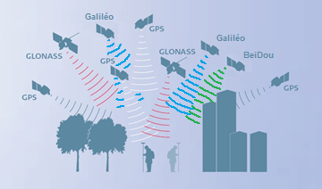
Different satellites
Until today, we used the generic term GPS for Global Positioning System to describe the various geopositioning equipment.
However, this term is actually the name of a set of 24 American satellites placed in orbit at an altitude of 20,000 km. This constellation of satellites, which was the first in history, therefore left its name to geopositioning technology.
These satellites revolve around the earth and are therefore in constant motion. To establish a position, a minimum of 5 satellites is required.
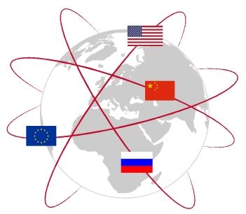
Other satellite constellations have thus been commissioned by other countries: Glonass for Russia, Beidou for China and more recently Galileo for Europe have also been commissioned, all of which are available in France. All of these constellations are grouped together under the single name of GNSS for Global Navigation Satellite System. These satellites revolve around the earth and are therefore in constant motion. To establish a position, a minimum of 5 satellites is required.
Dilution of GDOP, HDOP accuracy…
The HDOP, a question of geometry
The positioning accuracy of a satellite navigation system (GPS) is affected by mathematical errors related to the geometry of observable satellites either because of their position and their distribution above the user.
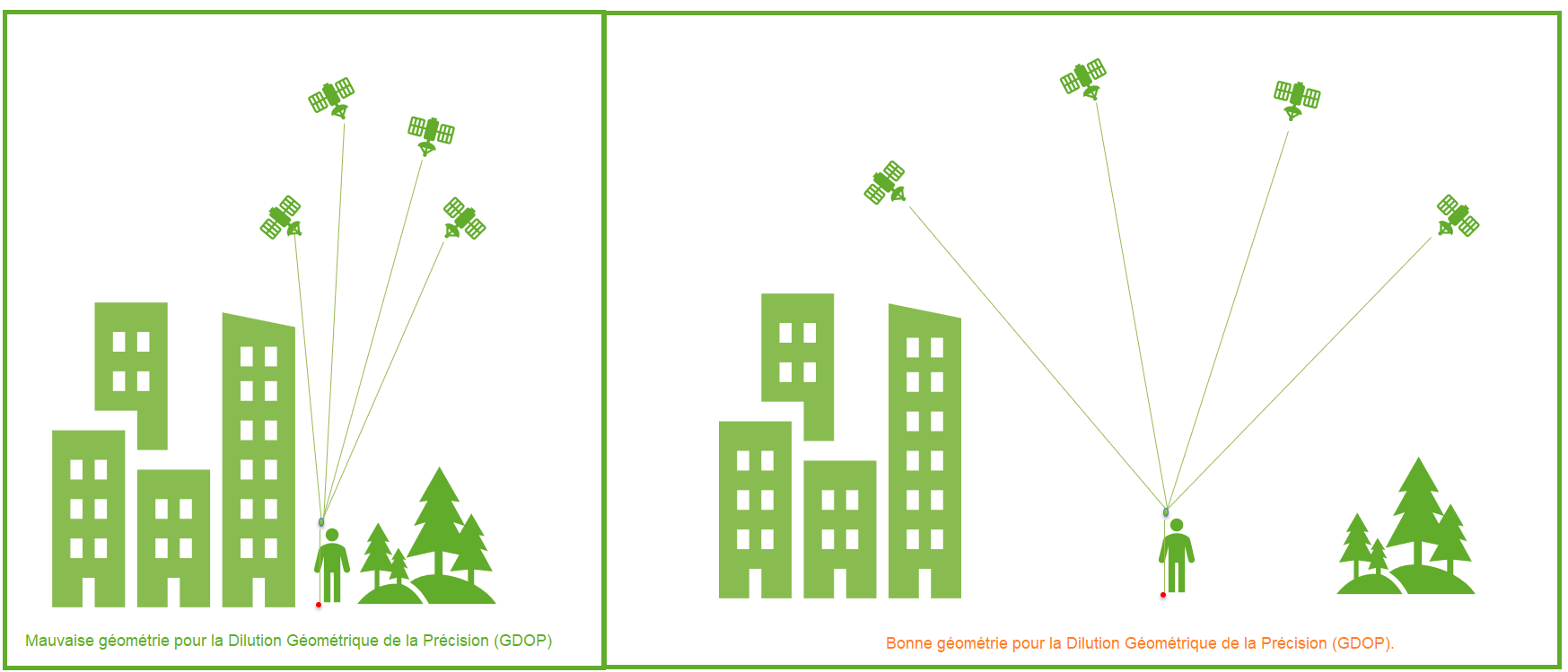
The idea of geometric DOP (GDOP) is to indicate how measurement errors will affect the final state estimate.
DOP can be expressed in a number of distinct measurements :
- HDOP – horizontal dilution of precision
- VDOP – vertical dilution of accuracy
- PDOP – position dilution (3D) of accuracy
- TDOP – temporal dilution of precision
- GDOP – geometric dilution of precision
Benchmarks
These values derive mathematically from the positions of the usable satellites. The signal receivers allow the display of these positions (skyplot) as well as the DOP values.
| Valeur DDP | Classement | La description |
|---|---|---|
| <1 | Idéal | Highest possible level of confidence to be used for applications requiring the highest possible accuracy at all times. |
| 1-2 | Excellent | At this level of confidence, position measurements are considered accurate enough to meet all but the most sensitive applications.. |
| 2-5 | Bien | Represents a level that marks the appropriate minimum for making accurate decisions. Position measurements could be used to make reliable navigation suggestions to the user. |
| 5-10 | Modérer | Position measurements could be used for calculations, but the quality of the correction could still be improved. A clearer view of the sky is recommended. |
| 10-20 | Équitable | Represents a low confidence level. Position measurements should be ignored or used only to indicate a very rough estimate of the current location. |
| >20 | Pauvre | At this level, measurements are inaccurate out to 300 meters with an accurate 6 meter device (50 DOP × 6 meters) and should be discarded. |
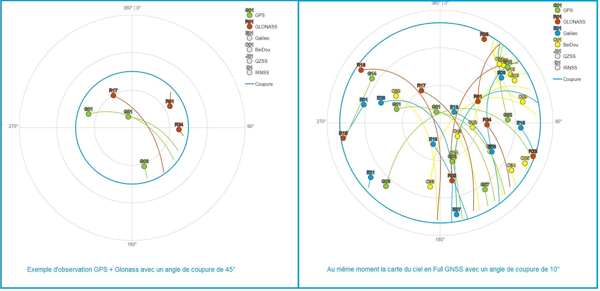
Sky map
The sky map allows you to get a good idea of the distribution of the satellites above you and therefore potentially of the DOP problems that you could encounter.
Example of observation of the sky of the GPS and Glonass constellations with a cut-off angle of 45° compared to the sky map in Full GNSS with a cut-off angle of 10°.
The strength of the Orpheon network
Our network is currently built according to the rules of the art with stations every 60 km, you should not normally be too affected. However, we wanted to pass on the information to you, an informed user is worth two!
The interest of Multifrequencies L1/L2 and L5
The use of multiple frequencies allows better rejection of repair signals, which allows a maximum of direct signals to be processed, which provides greater precision and greater positioning repeatability.
The positioning of the Orpheon network observation stations and the correction calculations based on the L1 and L5 frequencies emitted by the satellites make the positioning more resistant to interference and signal reflections, particularly in an urban environment.
Concretely, the initialization time and the delay to fix or convergence are significantly reduced as well as the repositioning times in the event of disconnection.
The highest availability rate on the market
The strength of the Orphéon network is to have been integrated into the largest European network to share infrastructures and the most qualified technical teams and to guarantee identical control procedures over the entire coverage area, continuous and regular reinforced monitoring of all stations and the network. This international technical team from a major manufacturer is responsible for supervising all the installations 24/365.
The Orpheon network compatible with Galileo and BeiDou
Orphéon becomes the first 100% Full GNSS network in France
Since September 7, 2017, all of the reference stations, the infrastructure and the correction calculation software allow us to deliver NRTK Full GNSS corrections including
![]()
GPS + GLONASS + Galiléo + BeiDou.
A choice of GNSS hardware and receiver for the network
The GNSS stations of the Orphéon network are all of the same brand, to limit measurement noise between sensors and allow 100% calculations of Full GNSS corrections in the network (GPS + GLONASS + Galileo + BeiDou). In addition, the stations are all the property of Geodata Diffusion, so as to ensure durability and performance.
The uncompromising choice of the hardware used to create the Orpheon network
All sensors and antennas are of the same brand so that electronic biases are perfectly controlled or at least constant in the network RTK calculation.
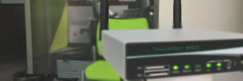
The station’s GPS/GNSS antenna is connected by an antenna cable to an electrical box housing:
- The GPS / GNSS receiver.
- A modem to connect it to our proprietary telecommunications network.
- All the automation necessary to restart the site remotely in the event of equipment unavailability.
- Split data transmission for higher availability