Sustainable development
In addition, the Surveyors-Experts have introduced, in addition to a methodological approach to their work, a Sustainable Development approach for each of their services and can, here too, count on the assets of the Orphéon network to:
- Perpetuate the land boundaries (georeference the works in the national geographic coordinate system in force in order to guarantee their consistency and the interoperability of the data)
- Dematerialization of the documents produced (plans, plot reports, etc.) and delivery of the documents in the form of computer files.
- Dematerialization of procedures: (Use of smart RFID terminals, boundary report, documents on digital media, etc.)
- Sustain and update legal, land and administrative information
- Conflict prevention in land operations
- Optimize the movement of field vehicles
- Manage construction waste
knowledge of the earth :
Thus the monitoring of the movements of elements on the earth’s surface is an essential element for feeding analyzes of the evolution of the climate and the environment.
Thanks to geodesy measurement techniques, it is possible to follow tectonic movements to the nearest centimetre.
It is also possible to study the Earth’s atmosphere by analyzing the propagation of signals from positioning satellites in the different layers.
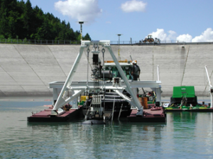
Precision geopositioning also makes it possible to study the oceans and sea currents thanks to floating beacons equipped with GNSS receivers and operating 24 hours a day.
In the prevention of flood risks :
- Catchment Study: Nominal Terrain Survey for Runoff and Flood Simulation
- Georeferencing of measuring points (wells, meteors etc.)
In precision agriculture, reasoned production:
Monitoring the state of soils, crops, from seed to harvest, thanks to methodical monitoring and databases (GIS) then by crossing these data with the operating equipment itself connected and geolocated with precision, it is possible to reduce the quantity of pesticides or fertilizers spread, by determining and then administering precisely the quantities necessary in small areas. It is thus also possible to control the necessary watering more efficiently.
Territorial monitoring and population protection
In the prevention of landslide risks:
The monitoring of unstable areas consists of identifying cracks and shifts in the ground. tracking of ground movements using GPS measurements is carried out in the most active areas. These measurements made it possible to know that the earth moves in places by 80 cm per year on average, imperceptibly.
Mountain slopes, for their geological diversity, their steep slopes and the multiple degradation factors (freeze-thaw, rainfall, earthquakes) that affect them, require often costly protection measures and risk management procedures.
But also the very strong increase in traffic, both road and rail, has gradually highlighted the high vulnerability of transport infrastructures to natural risks and the costs, both human and financial, that they could represent.
The stability of a slope or cliff can be affected by the following external factors:
- climatic phenomena: rain, snowmelt, cyclone, monsoon, freeze-thaw cycle, thermal gradient;
- hydrological phenomena: modification of superficial and deep flows, coastal erosion, erosion of the foot of the slope by the bed of a watercourse, rapid decrease in the level of a river at the foot of the slope, flooding, impoundment of a blocade ;
- phenomena that are sources of vibrations: earthquake, vibration linked to mining activity or the presence of infrastructure;
- anthropogenic actions: earthworks at the foot of the slope, overloading at the crest, insufficient control of water discharges and surface runoff. The presence of water, through the development of pore pressures in the unstable mass of soils or rocks, is often considered to be the preponderant triggering factor.
Reasons for setting up a monitoring system:
- Safety of installations and populations
- Warning and risk prevention systems
- Maintenance and renovation program
- Development plans, reforestation, grassland
- Watershed management
Monitoring of works of art
Monitoring the phenomenon of aging of engineering structures consists of identifying and then monitoring the signs that reflect this aging and monitoring the effectiveness of the measures implemented to control it. Depending on the nature, structure and classification of the structures concerned, various monitoring programs are put in place; either by regular inspection visits, or by the installation of permanent monitoring means.
Applications
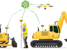
All operations requiring centimeter precision are faster, more efficient, and more economical. From the preparatory study phases, to the construction or development operations and end-of-site control, everything is optimized.
We offer you an overview of the different applications of the Orpheon network.