Network or single-station solution?
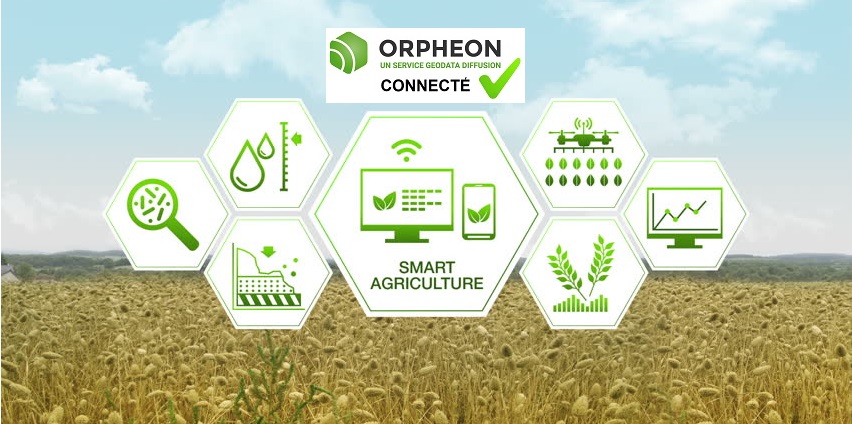
The Orpheon signal for Precision Agriculture
 For agriculture, Géodata Diffusion offers 2 types of complementary services adapted to the different works to be carried out and allowing adaptation to everyone’s budget.
- Soit un signal Orphéon en mode corrections Réseau National N-RTK
- Soit un signal Orphéon en mode corrections Mono-Station automatique la plus proche RTK
In order to be able to determine which services best suit your needs, we offer an overview to present each of these services and the type of work concerned and the corresponding Orpheon corrections signal.
 1 – N-RTK network centimeter corrections
The Premium service: corrections in network mode
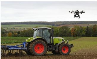
This is the Orpheon reference service, because this type of correction makes it possible to achieve the most constant precision of the order of a centimeter in the field throughout the year. The corrections signal is obtained from a cell of several Orpheon Stations around the user. The correction provided is repeatable, making it possible to return to the exact same spot. These corrections can be used with an auto-steer equipped with an electric servo wheel, but you will obtain even more repeatable and precise work with a hydraulic servo wheel (factory installation or retrofit, ask your dealer) . Due to its stability, it is the solution that offers the most possibilities and flexibility in terms of the type of work that can be performed, but also the greatest availability and precision of corrections over time, for the most common works up to to more demanding jobs.A Full GNSS network
The addition of the GALILEO and BeiDou constellations thanks to the Orphéon network is not a simple gadget, but the assurance of better daily productivity in the field. Indeed, you can now count permanently on the constant availability of at least 6 additional satellites and bring you real advantages:Improved positioning quality
-
-
-
- More satellites available to calculate its position
- Precise positioning even in difficult environments (near trees or buildings for example)
- Improved positioning reliability
- Shorter fixing time
-
-
Technically:
NRTK (Network Real Time Kinematic) is a type of real-time GNSS correction that is the only correction whose accuracy consistently allows you to return to the same location month after month. At each instant, the position calculated using several bases of the network to be compared with the real and known position of each base. The differential thus calculated constitutes the high precision correction to be applied to the tractor.Results* :
An accuracy of ± 3.5 cm, 95% of the time, i.e. a correction of less than ± 2 cm on average. * Independent tests carried out by Arvalis (Institut du Végétal) in August-2015Type of work involved:
- Fast and wide tillage,
- cereal sowing,
- Intra-plot modulation,
- Spreading and spraying guidance,
- Guidance of Autonomous Robots
- Cutting of spreader and sprayer sections.
- Hoeing,
- Mowing,
- potato mounding,
- Precision sowing, monogrins
- Strip-till,
- Cereal harvests
The Most Geodata :
Irreproachable Full GNSS precision, for all the cultivation work from the simplest to the most demanding, a service availability rate, no limit to the radius of action.Additional satellites :
The addition of the Galileo and BeiDou satellites to the GPS and GLONASS satellites means that you can always count on the constant availability of at least 6 additional satellites to bring you real advantages:
- More satellites available to calculate its position
- Precise positioning even in difficult environments (near trees or buildings for example)
- Improved positioning reliability
- Shorter fixing time
2 – The centimetric Mono-Station or simple RTK solution
The service: corrections in automatic Single-Station mode
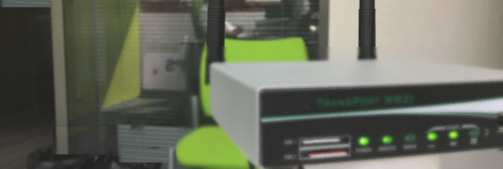
This type of correction makes it possible to achieve a precision according to the specifications of the GNSS equipment used and the distance separating it from the ORPHEON station to which you are connected. The corrections signal is obtained automatically from the Orpheon Station closest to the user.
No need to change your settings
For the user, a single mounting point to access all our stations, it is the server that switches depending on your position. So no modification of your parameters if you move. The accuracy provided is repeatable and close to the network N-RTK solution without achieving the same level of stability, but with a much lower annual fee.An excellent compromise
It thus offers a very good compromise. These corrections can be used with an autosteer equipped with an electric servo wheel, but you will get more repeatable and precise work with a hydraulic servo wheel (factory or retrofitted, ask your dealer). This solution offers a lot of possibilities in terms of the type of precision work that can be done in the field.
Technically:
RTK (Real Time Kinematic) is a type of real-time GNSS correction that is based on the use of a single ORPHEON permanent base station. At each instant, the calculated position to be compared with the real and known position of the base station. The calculated differential is the accuracy correction to be applied to the tractor.Résults* :
An accuracy of ± 3.7 cm, 95% of the time, a correction of less than ± 2 cm on average for a baseline of 30 km. *Independent tests carried out by Arvalis (Institut du Végétal) in August-2015Type of work involved*:
Depending on the work area, it is possible to carry out:* It is advisable to find out about the position of the nearest base antenna and to carry out a few tests in order to determine in practice the type of work that can be carried out in your work area.
- Fast and wide tillage,
- cereal sowing,
- Intra-plot modulation,
- Spreading and spraying guidance,
- Guidance of autonomous robots
- Cutting of spreader and sprayer sections.
- Hoeing,
- potato mounding,
- precision sowing,
- Strip-till,
- grain harvest
The Most Geodata:
Single-Station subscriptions allow you to automatically connect to the base station closest to your work area throughout the national territory to establish the shortest possible baseline and offer you the best accuracy.