Orphéon is a real-time RTK Full GNSS precision augmentation GPS correction system allowing users to position themselves with centimeter precision in the national reference anywhere in France and the West Indies with a single GNSS receiver:
Provide RTK GPS corrections
The Orphéon network is made up of nearly 220 observation stations, spread over the entire territory of metropolitan France and the West Indies.
All of our stations form a large balanced RTK network that allows us to deliver centimeter RTK corrections to our many customers to increase the accuracy of their precision GPS. Our various services are marketed in the form of subscriptions or hourly packages.
Accuracy and availability
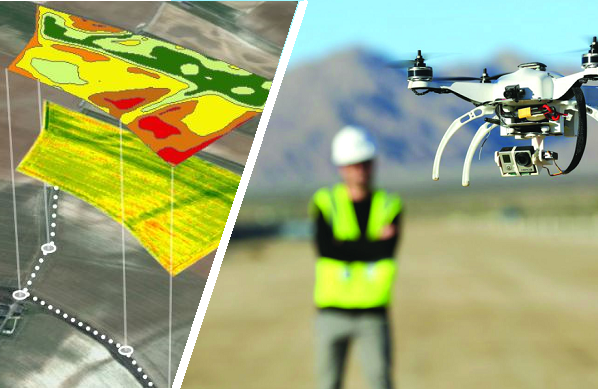
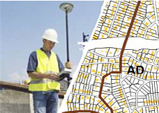
Thanks to its precision and the availability of its RTK GPS corrections, the Orpheon network offers increased productivity to all of its users in the fields of topography, construction, 3D digitization, machine control, precision agriculture and bathymetry, but also for new applications concerning autonomous vehicles, drones (UAV) and connected objects (IOT and M2M).
Géodata Diffusion continues to develop the quality of its services through personalized support, responsive technical assistance and continuous improvement of its infrastructures. Our objective is to offer customers a secure and innovative service, guaranteeing them a high and constant utilization rate wherever they are, throughout the territory.
GPS Accuracy
The natural position provided by a GPS alone, gives a good idea of where it is within a few meters, but is not precise enough to allow precision work. It requires correction so that its precision is increased and usable in agricultural work, topography, machine guidance or in many other fields of application (see).
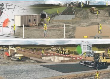
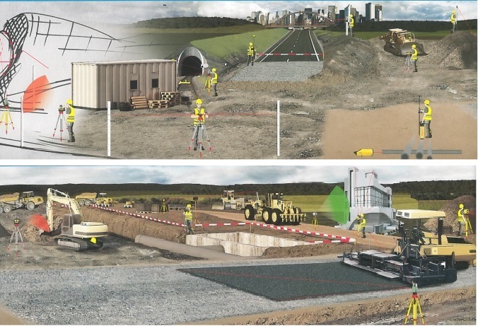
For all your construction work
Digital Terrain Model (DTM) Survey.
Cubatures to determine quantities of materials.
Implantation and setting up of stakes (definition of entries into the ground, positioning of structures, definition of alignments).
Execution checks.
As-built plans.
Earthworks projects
Nominal ground surveys for the realization of your quotes.
Easier management of several projects: you have the freedom to intervene on sites even if all your RTK bases are already mobilized on other projects.
Interventions on the opening of the trace, upstream of the possible installation of a base in the case of large construction sites or large
structures: definition of the stripping zones, definition of the axes for the large bulls and the scrapers, controls of layers.
Road projects
Installation of life bases, site tracks, restorations, temporary roads, on small bypasses.
The Premium Orpheon offer
These subscriptions give access to unlimited Real-Time correction services in the NRTK Full GNSS centimetric repeatable GPS + Glonass + Galileo + BeiDou network.
The non-binding offer
This is access to the N-RTK GNSS correction network with real-time centimeter accuracy (GPS, Glonass). Often used to discover our services.
The 3D control offer
This is access to the N-RTK Full GNSS correction network with centimeter precision (GPS, Glonass, Galileo, Beidou). Often used to control the accuracy of its measurements or even for areas where a mobile internet connection is not available for real time.
Benefits
In your professional practice you can count on the knowledge, the know-how and the centimetric precision of the Orphéon network to meet your missions and your obligations.
The network has been thought out and designed according to the rules of the art, it is constantly monitored and checked regularly. (The network-Orpheon).
Everything has been thought out to allow you to benefit from increased productivity.
With the Orphéon network, you work with identical precision throughout the territory thanks to a uniform distribution of stations in metropolitan France and the West Indies. Whatever your position, the distance from the nearest reference station is never more than 30 km.
100% Galileo and BeiDou correction services in addition to GPS and GLONASS:
more satellites (+22 Galileo)
faster fixing,
more measurement stability,
more availability,
better positioning
fewer multipaths
Choose your area of coverage and your duration of commitment according to your real need for an adapted price and discounts
Thanks to the mobile internet connection, you are not limited by the range of radio systems and you do not have to deal with questions of frequencies or interference. The time saved allows you to multiply the work and concentrate on your production.
With Orpheon, preparation work is reduced to a minimum and you can start working faster. No pivot deployment to plan or monitor.
Choose your area of coverage and your duration of commitment according to your real need for an adapted price and discounts
RTK precision positioning geo-references your measurements or photogrammetry images in one step in real time to save production time. Or even as a control tool thanks to the post-processing available online.
A regular mesh and a reinforced infrastructure for you to secure data transfer, for greater reliability and repeatability on a daily basis.
The availability of the service gives the possibility to work from day to night, in foggy weather etc. by focusing their attention on the GPS guidance tool and no longer on driving for an always impeccable result