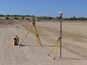
Orphéon is a real-time RTK Full GNSS precision augmentation GPS correction system allowing users to position themselves with centimeter precision in the national reference anywhere in France and the West Indies with a single GNSS receiver:
Provide RTK GPS corrections
The Orphéon network is made up of nearly 220 observation stations, spread over the entire territory of metropolitan France and the West Indies.
All of our stations form a large balanced RTK network that allows us to deliver centimeter RTK corrections to our many customers to increase the accuracy of their precision GPS. Our various services are marketed in the form of subscriptions or hourly packages.
Accuracy and availability
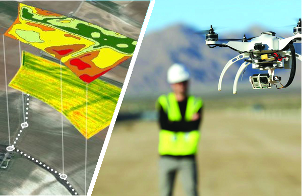
Thanks to its precision and the availability of its RTK GPS corrections, the Orpheon network offers increased productivity to all of its users in the fields of topography, construction, 3D digitization, machine control, precision agriculture and bathymetry, but also for new applications concerning autonomous vehicles, drones (UAV) and connected objects (IOT and M2M).
Géodata Diffusion continues to develop the quality of its services through personalized support, responsive technical assistance and continuous improvement of its infrastructures. Our objective is to offer customers a secure and innovative service, guaranteeing them a high and constant utilization rate wherever they are, throughout the territory.
GPS Accuracy
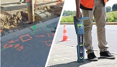
The natural position provided by a GPS alone, gives a good idea of where it is within a few meters, but is not precise enough to allow precision work. It requires correction so that its precision is increased and usable in agricultural work, topography, machine guidance or in many other fields of application (see).
In your most varied missions
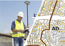
The high precision that the GNSS RTK Orphéon network provides to surveyors or topographers, allows them to carry out quality surveys or layouts with complete confidence, but also facilitates and simplifies the management of your construction sites or your interventions in the field.
Optimized production
Real-time positioning correction throughout the territory also allows you to use the data collected directly in the national reference system and thus free you from post-processing work.
Data exchange between the site and the office is now made possible by equipment connected to mobile internet. Thanks to the mobile internet connection, you are not limited by the range of radio systems and you do not have to deal with questions of frequencies or interference. The time saved allows you to multiply the work and concentrate on your production.
The optimization of information, digitized data or geo-located photos thus collected allow better preparation or better control of renderings or even the consideration and traceability of specific needs according to your different missions:
Land development
Amicable, judicial demarcation,
Survey property lines and fences,
Property Division,
Maintenance of the cadastral plan,
Cadastral conservation and land registration,
Cadastral Concordance,
Raising buildings,
Plan of easements attached to the property
Judicial expertise, amicable, arbitration
Roads, Survey of communication routes and hydrography
Survey of various networks, VRD
Preliminary study and land development (Agricultural, forestry)
consolidation,
Project management and project management assistance
In addition, the Surveyors-Experts have introduced, in addition to a methodological approach to their work, a Sustainable Development approach for each of their services and can, here too, count on the assets of the Orphéon network to:
Perpetuate the land boundaries (georeference the works in the national geographic coordinate system in force in order to guarantee their consistency and the interoperability of the data)
Dematerialization of the documents produced (plans, plot reports, etc.) and delivery of the documents in the form of computer files.
Dematerialization of procedures: (Use of smart RFID terminals, boundary report, documents on digital media, etc.)
Sustain and update legal, land and administrative information
The Premium Orpheon offer
These subscriptions give access to unlimited Real-Time correction services in the NRTK Full GNSS centimetric repeatable GPS + Glonass + Galileo + BeiDou network.
The non-binding offer
This is access to the N-RTK GNSS correction network with real-time centimeter accuracy (GPS, Glonass). Often used to discover our services.
The 3D control offer
This is access to the N-RTK Full GNSS correction network with centimeter precision (GPS, Glonass, Galileo, Beidou). Often used to control the accuracy of its measurements or even for areas where a mobile internet connection is not available for real time.
Benefits
In your professional practice you can count on the knowledge, the know-how and the centimetric precision of the Orphéon network to meet your missions and your obligations.
The network has been thought out and designed according to the rules of the art, it is constantly monitored and checked regularly. (The network-Orpheon).
Everything has been thought out to allow you to benefit from increased productivity.
With the Orphéon network, you work with identical precision throughout the territory thanks to a uniform distribution of stations in metropolitan France and the West Indies. Whatever your position, the distance from the nearest reference station is never more than 30 km.
100% Galileo and BeiDou correction services in addition to GPS and GLONASS:
more satellites (+22 Galileo)
faster fixing,
more measurement stability,
more availability,
better positioning
fewer multipaths
RTK precision positioning allows you to geo-reference your measurements simply and confidently in the national reference system in real time to save production time. Or even as a control tool thanks to the post-processing available online.
Thanks to the mobile internet connection, you are not limited by the range of radio systems and you do not have to deal with questions of frequencies or interference. The time saved allows you to multiply the work and concentrate on your production.
With Orpheon, preparation work is reduced to a minimum and you can start working faster. No pivot deployment to plan or monitor.
Choose your area of coverage and your duration of commitment according to your real need for an adapted price and discounts
RTK precision positioning allows you to geo-reference your measurements simply and confidently in the national reference system in real time to save production time. Or even as a control tool thanks to the post-processing available online.
A regular mesh and a reinforced infrastructure for you to secure data transfer, for greater reliability and repeatability on a daily basis.
The availability of the service gives the possibility to work from day to night, in foggy weather etc. by focusing their attention on the GPS guidance tool and no longer on driving for an always impeccable result