Share the post "RTK autonomous vehicles: precise navigation and tracking"

The Orphéon network: precision and availability at all times
Autonomous vehicles
The autonomous vehicle market is growing at high speed. Car manufacturers and equipment suppliers, but also new entrants such as web giants, are increasing their projects and road tests across Europe.
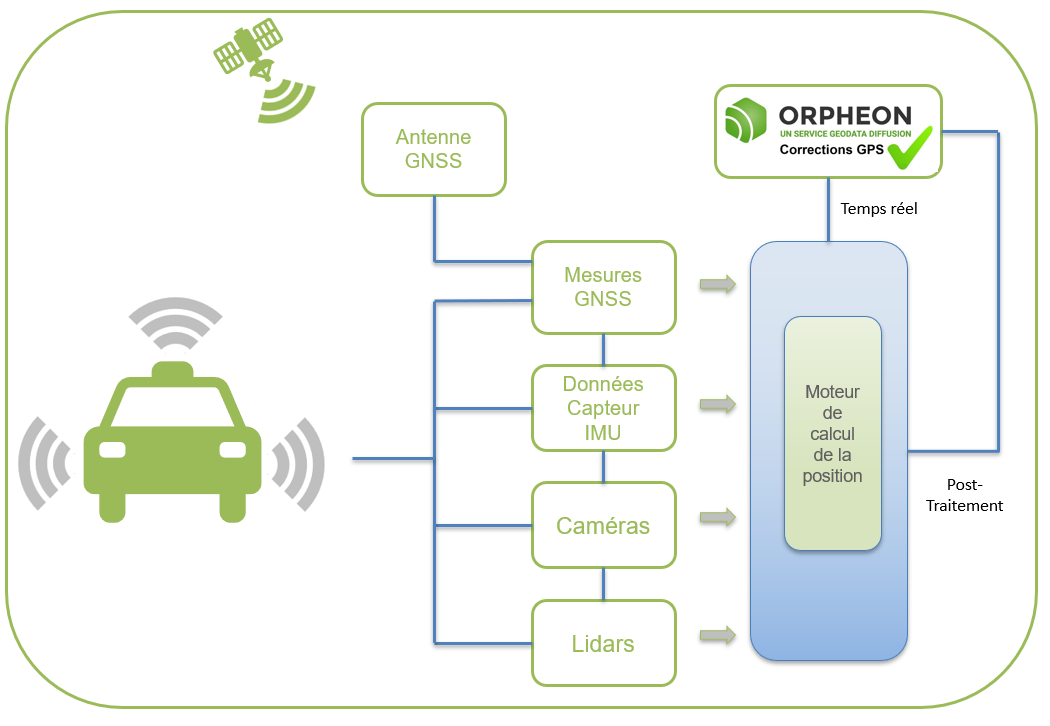
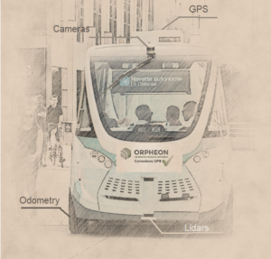
Different technologies come into play (cameras, LIDAR, inertial units, GNSS positioning, etc.) all to ensure precise control and when we talk about precision, Géodata Diffusion has its say.
The adoption of precision GPS guidance with RTK corrections from the Orphéon network in addition to optical security elements or even miniature inertial units adds the interest of GPS through its flexibility to adapt to all types situation. The Orphéon network has demonstrated the value of its national infrastructure in France but also its integration into a global network opening up wide possibilities for manufacturers.
The expertise of Hexagon
Hexagon develops and brings together technologies, solutions and services into a cohesive offering to provide the most precise positions in any environment. Hexagon combines both sensor fusion and GNSS expertise, global correction services infrastructure, authentication and integrity to alleviate the limitations of GNSS and provide precise and reliable positioning.
Travel anywhere in Europe with HxGN SmartNet

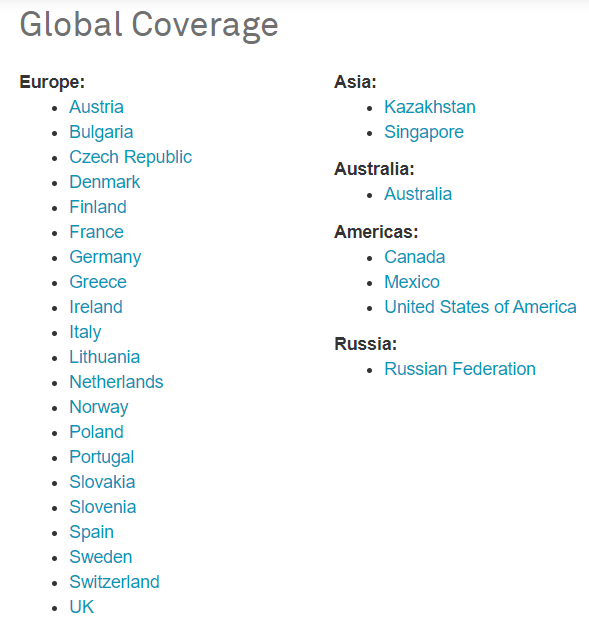
By joining the Hexagon group in 2014, the Orphéon network joins a vast network of reference stations within the first operational European NRTK network operating in 25 countries including 18 in Europe. Drawing on its international experience and its expertise in real-time positioning, the Hexagon group, within its various companies, intends to offer the most consistent and extensive real-time positioning service with centimeter precision.
The strength of the European network is to share infrastructures and the most qualified technical teams to guarantee identical control procedures across the entire coverage area, continuous and regular reinforced monitoring of all stations and the network. This international technical team from a major manufacturer is responsible for supervising all installations 24 hours a day, 365 days.
HxGN SmartNet allows you to travel without interruption in more than 20 European countries.
With more than 5,300 reference stations worldwide, HxGN SmartNet is the world’s largest provider of satellite-based correction services (GNSS).
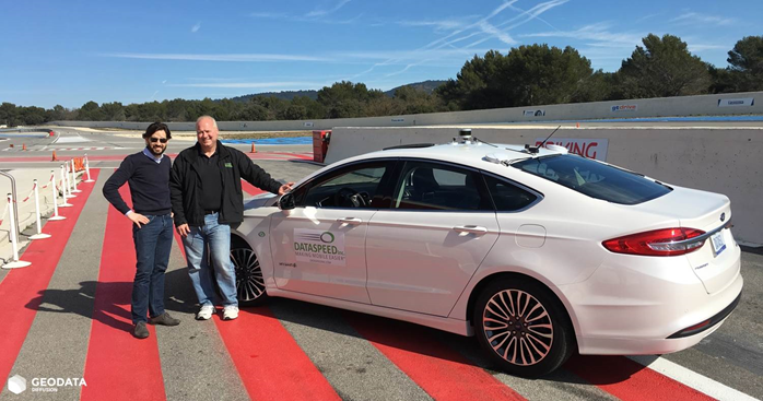
On February 22, 2017 we were at Le Castellet on the Paul Ricard circuit alongside Dataspeed for full-scale tests … lire l’article

For your Trajectography work
In dynamic measurement operations, the integration of GPS RTK, LiDAR, and latest generation inertial units combined with GNSS corrections generated via the Orphéon network allow both:
-
-
-
- rapid implementation and simplified deployment,
- while guaranteeing an optimum level of precision
- they allow you to do without a second GNSS receiver (base)
- to considerably reduce or even eliminate the implementation of control points depending on the applications.
-
-
These corrections, provided in real time or in post processing via the RINEX files of our permanent stations, also make it possible to facilitate and significantly reduce the processing of data or images.
Navigation
Knowing your position, your heading, your movements, are all essential data that you need to have when you are on the move. Precision is your greatest ally because it provides security for you and your direct environment.
Everything has been designed to allow you to benefit from increased security.
- Centimeter precision corrections for GPS
- Real time, very fast convergence time
- A dense and homogeneous RTK network
- A regular and geometric layout throughout the territory
- An infrastructure designed for service performance
- Very secure facilities
- National and Antilles coverage
- A reference for professionals
- Accuracy, Stability, Availability, Repeatability
- Increasingly varied applications
Orphéon Online Post-Processing Service
Vos résultats en un clic
Since January 1, 2019, we have expanded our service offering by offering new, simplified online services to all of our users. Our online application now allows you to post-process your data with calculated virtual stations, just as for post-processing your data from data from the physical stations of the Orphéon network, allowing:
-
-
-
- To post-process with data from Orphéon network stations your raw GNSS data recorded in the field in RINEX format, whether physical stations but also now with calculated virtual stations.
- To download raw GNSS data in RINEX format from physical stations in the Orphéon network in order to carry out personalized post-processing.
- Constant centimeter precision Full GNSS, GPS + Glonass + Galileo + BeiDou
-
-


