![]()
Geodata Diffusion operator of the Orphéon network of permanent GNSS stations ,
created in 2004, has become a major player in GNSS satellite positioning in France. A pioneer in the establishment of the first permanent Full GNSS precision augmentation network on the national territory, the company today covers a large number of applications through a large network of approved distribution partners for all brands of receivers GNSS.

Orpheon RTK corrections: Precision in all areas
The Orpheon network allows us to market correction services to improve GPS positioning with centimeter precision, mainly used by different companies for their professional missions:
The first NRTK FULL GNSS network in France
![]() Orpheon, the first Full GNSS network in France, offers high-precision geopositioning correction services, increased confidence and productivity to all of its users in many areas but also for new applications concerning autonomous vehicles, drones (UAV) and connected objects (IOT and M2M).
Orpheon, the first Full GNSS network in France, offers high-precision geopositioning correction services, increased confidence and productivity to all of its users in many areas but also for new applications concerning autonomous vehicles, drones (UAV) and connected objects (IOT and M2M).
Provide GPS RTK corrections
The Orpheon network is made up of nearly 220 permanent observation stations distributed throughout mainland France and the Antilles. All these stations are Full GNSS, namely: GPS, GLONASS, Galileo and BeiDou.
All of our stations form a large balanced RTK network which allows us to provide our numerous customers with centimeter RTK corrections to increase the precision of their precision GPS. Our various services are marketed in the form of subscriptions or hourly packages.
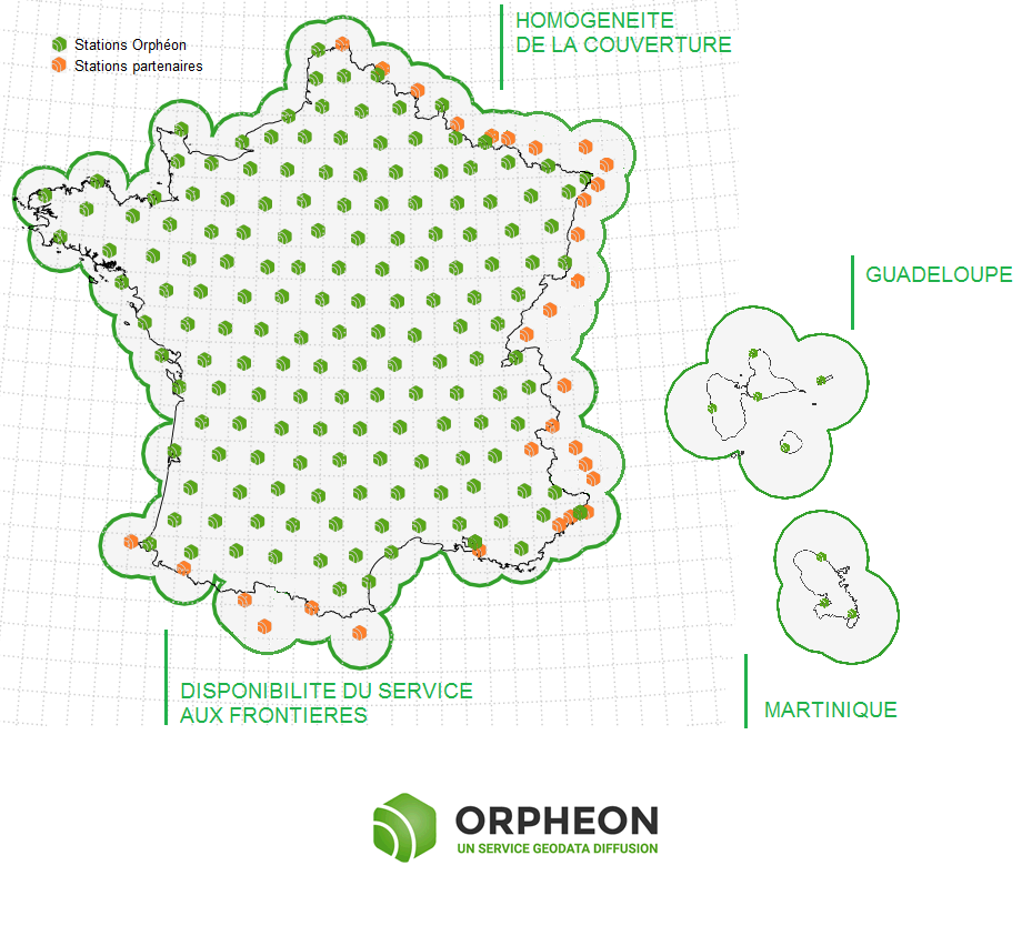
Click on the map to access the interactive network map
Accuracy and availability
Géodata Diffusion continues to develop the quality of its services through personalized support, responsive technical assistance and continuous improvement of its infrastructures. Our objective is to offer customers a secure and innovative service, guaranteeing them a high and constant usage rate wherever they are, throughout the country.
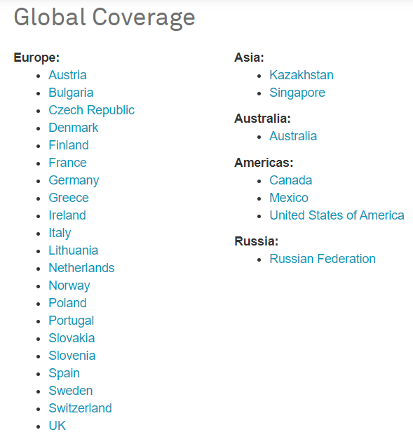
Integration into a large European network
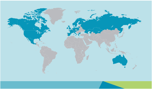
By joining the Hexagon group in 2014, the Orphéon network joins a vast network of reference stations within the first operational European NRTK network operating in 25 countries including 18 in Europe. Drawing on its international experience and its expertise in real-time positioning, the Hexagon group, within its various companies, intends to offer the most consistent and extensive real-time positioning service with centimeter precision.
This secure infrastructure, set up and managed by the Hexagon group, allows the pooling of resources whose management is centralized. It also allows you to organize a service available 24/7 and offer one of the highest availability rates on the market.
Increasing real-time positioning accuracy has become a critical issue and requirement for high-growth areas such as autonomous navigation and precision agriculture.
Drawing on its international experience and its expertise in real-time positioning, the Hexagon group, within its various companies, intends to offer the most homogeneous and most extensive real-time positioning service with centimeter precision.
To guarantee continuous service and consistent quality across the entire territory, we share reference sites within the European network of our Hexagon AB group.
The service is marketed under the HxGN SmartNet brand
This European network allows us to integrate additional reference stations and extend the coverage of the Orphéon network for French customers. Coverage is enhanced at borders through the sharing of reference stations from our international Hxgn SmartNet network. In this way, even near a border, it is possible to work in a network while being within an RTK cell (and no longer in extrapolated mode).
![]()
The highest availability rate on the market
The strength of the European network is to share infrastructures and the most qualified technical teams to guarantee identical control procedures across the entire coverage area, continuous and regular reinforced monitoring of all stations and the network. This international technical team from a major manufacturer is responsible for supervising all installations 24 hours a day, 365 days.
The main axes for Geodata Diffusion
![]()
1- Imagining the future of Orpheon
2- Addressing new sectors of innovation
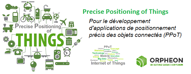
Thanks to the development of technologies and the appearance of the Internet of Things (IoT: Internet Of Things) allowing them to communicate, it became obvious that we now needed to locate these objects precisely.
Some connected objects are fixed and do not change place, but a very large number of these objects accompany us on our trips or are simply in motion.
It then becomes very interesting and even essential to be able, at any moment or retrospectively, to locate or precisely materialize their position or their movements.