Share the post "Referencing and external control of the network"
For the highest quality of your measurements
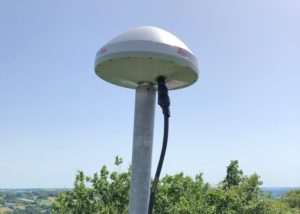
Each of the reception sites for the reference stations in the Orphéon network is selected with the greatest care and must respect criteria allowing stability and the best reception of satellite signals. The buildings on which the antenna masts are stowed were selected primarily on the basis of stability criteria. The antenna masts are designed (diameter and thickness of sheets) to ensure subcentimetric stability of the phase center of the antenna, under all usual weather conditions (dilation under the effect of temperature and vibration under the effect of wind). © Leica CrossCheck
Stationing procedure
After the final installation of a reference station on a new site or after maintenance, we obtain a first approximate position of this site by observations over a minimum period of 72 hours. This duration makes it possible to obtain the first coordinates of the site. Then these observations are conducted over a month in order to acquire the time series which will be used to calculate the position thanks to the Leica CrossCheck Solution (service for calculating the coordinates of the GNSS reference station and monitoring the integrity of the network) and Bernese GNSS software (high-precision scientific multi-GNSS data processing software developed at the Astronomical Institute of the University of Bern (AIUB). Leica Geosystems experts process this geodetic GNSS data to provide high-precision estimates of the positioning and movements of each of the sites making up the Orpheon network.Referencing
All the sites are referenced in the RGF93 via a “state of the art” procedure from the stations of the RGP (Permanent GNSS Network). The RGF93 is a national reference:- three-dimensional geocentric
- linked to the global ITRS reference system
- associated with the IAG GRS 1980 spheroid
- having as its prime meridian the International Meridian (or Greenwich Meridian)
- having as associated projections the Lambert-93 projection and the CC 9 Zones projections
- horizontal accuracy between 1 and 2 cm (compared to global systems)
- vertical accuracy between 2 and 5 cm (compared to global systems)
- suitable for modern positioning techniques
We then obtain the position and the precise three-dimensional coordinates of the site which we can then integrate into the network to deliver the correction services.
LAMBERT parameters and Geoid model
In metropolitan and continental France, the legal geodetic system is RGF93v2b which is aligned with ETRF2000 epoch 2019.0. All of our station coordinates are defined in this system. The associated ellipsoid is GRS80. The legal projection is the Lambert 93 9 zone conformal conic projection. Each of these zones covers a latitude band of 2°. The titles of the 9 zones are: CC42/CC43/CC44/CC45/CC46/CC47/CC48/CC49/CC50. “CC” for conformal conic followed by the value of the zone’s central parallel. For example, CC48 covers a band in latitude going from parallel 47°N to parallel 49°N. The definition of these 9 zones ensures an overlap of 1° between each zone. The parameters of these projections are: – Origin latitude: 42/43/…/50 depending on the area considered – Automecoic parallel 1: Origin latitude – 0.75° – Automecoic parallel 2: Origin latitude + 0.75° – Prime meridian: 3°E – Origin coordinates: 1,700,000 E; (1,000,000 x (origin latitude – 41°)) + 200,000 N In terms of altimetry, the legal system is IGN69, for mainland France, the RAF20 altimetric conversion surface was updated at the end of 2021 to take into account the maintenance operations of the RGF93 reference mark. Since the summer of 2021, you can therefore download this new ‘grid’ from the IGN website (https://geodesie.ign.fr) which takes into account both the evolution of the RGF93 benchmark (ETRF2000 ep.2019.0) and the last two ERNIT field campaigns 2019 and 2020 in mainland France. IGN is also trying to improve the model at each occurrence by introducing some minor corrections from reports or redeterminations caused by local tectonic activity. For mainland France, the RAF20 altimetric conversion surface was updated at the end of 2021 to take into account the maintenance operations of the RGF93 reference mark For Corsica, la surface de conversion altimétrique RAC09 reste en vigueur. For the West Indies : The RGAF09 (Réseau Géodésique des Antilles Françaises 2009) thus replaces the WGS84-RAAF91, which remains however usable for an overlay period of three years. As of 2019, RGAF09 is a significant improvement over WGS84. Indeed, it showed inconsistencies of several centimeters between the islands as well as an offset of about 70 cm with the International Terrestrial Reference System (ITRS).High quality centimetric positioning
Positioning accuracy with Orphéon is centimetric for a standard deviation of 1σ:- between 1 and 2 centimeters in planimetry (Lambert 93).
- between 2 and 3 cm in altimetry (IGN69).

Network control and monitoring
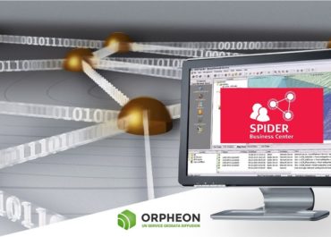
The Orpheon network is managed from the Leica Spider software operating solution allowing us to provide all real-time and post-processing services as well as to efficiently monitor our infrastructure, including user and access management, surveillance network status or individual connections.
 With GNSS Spider, we provide correction data using the method, format and communication channel that best suits the needs of our customers regardless of the brand of their equipment or the use they make of it. allows us to serve a large community of customers.
This solution supports various industry standard formats such as RTCM and technologies such as Ntrip to guarantee the best compatibility with the systems of all customers and to be able to provide them with responsive and quality technical support.
With GNSS Spider, we provide correction data using the method, format and communication channel that best suits the needs of our customers regardless of the brand of their equipment or the use they make of it. allows us to serve a large community of customers.
This solution supports various industry standard formats such as RTCM and technologies such as Ntrip to guarantee the best compatibility with the systems of all customers and to be able to provide them with responsive and quality technical support. In partnership with RENAG
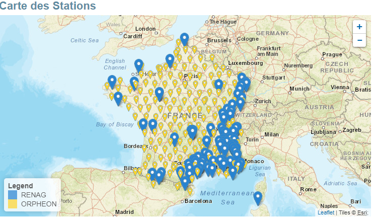
Géodata Diffusion is a private partner of RENAG (see RENAG website) RENAG brings together a set of research laboratories and state organizations that implement and use continuous GPS measurements for scientific purposes. RENAG is the National GNSS network of French research laboratories. This network is dedicated to scientific research and Earth observation in internal and external geophysics and geodesy. National Observatory, implementing and using continuous GPS measurements for scientific purposes such as: measurement of weak crustal deformations, study of the water vapor content of the atmosphere, study of oceanic and hydrostatic overload or study of movements gravity. Becoming a National Observation Service in 2006, its mission is to acquire, store and disseminate permanent GNSS data over the long term. As such, it receives financial support from the INSU-CNRS and the Ministry of Higher Education. RENAG is today a major component of the major French national facility RESIF-CORE and contributes through it to the major European research infrastructure EPOS. It also benefits from the material assistance of several public establishments such as IGN, CEA, IRSN and CNES. Since 2011, RENAG has been archiving and distributing restricted access data from the private partner Geodata Diffusion’s Orpheon network and using observation data for its scientific and academic research needs.
Self-checking and 24-hour monitoring
On a daily basis, we monitor 24 hours a day, all year round, the positioning of each of our reference stations using monitoring tools integrated into our Leica Spider correction calculation platforms. The monitoring of each of the reference stations is then carried out on a regular basis in order to control the stability of the sites. Internal quality control procedures are carried out regularly. In the field, we regularly check and compare the corrections obtained from the network by positioning ourselves with a mobile GNSS receiver, as our customers would do, on known points such as IGN terminals whose three-dimensional coordinates are known with precision.Automatic alerts
The entire network is monitored 24 hours a day and alerts are sent in real time to our technical support as soon as a movement or shift of a reference station is observed by the system. Our team is then able to intervene in order to ensure that a constant quality of service is maintained over time.
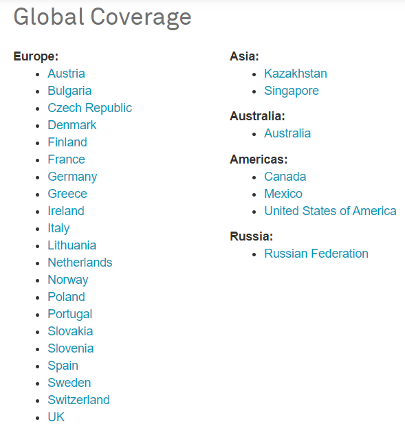
Integration into a European network
To guarantee a continuous and constant quality service throughout the territory, we share our reference sites within the European HxGN SMARTNET network of neighboring countries.
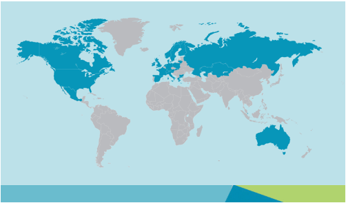 This European network allows us to integrate additional reference stations and extend the coverage of the Orphéon network for French customers. In this way, even near a border, it is possible to work in a network while being within an RTK cell (and no longer in extrapolated mode).
The strength of the European network is to guarantee identical control procedures over the entire coverage area, continuous and regular monitoring of all stations and the network thanks to an international technical team which supervises all installations 24 hours a day, 365 days a day. .
The network is used daily by thousands of professional subscribers. Major groups and research centers therefore trust our network for their various applications and can benefit from Hexagon’s expertise.
The service is marketed under the HxGN SmartNet brand
This European network allows us to integrate additional reference stations and extend the coverage of the Orphéon network for French customers. In this way, even near a border, it is possible to work in a network while being within an RTK cell (and no longer in extrapolated mode).
The strength of the European network is to guarantee identical control procedures over the entire coverage area, continuous and regular monitoring of all stations and the network thanks to an international technical team which supervises all installations 24 hours a day, 365 days a day. .
The network is used daily by thousands of professional subscribers. Major groups and research centers therefore trust our network for their various applications and can benefit from Hexagon’s expertise.
The service is marketed under the HxGN SmartNet brand
An infrastructure to match our ambitions
Continuous investments
Géodata Diffusion continuously invests in the infrastructure of the Orphéon network in order to constantly improve the quality and security of the services offered; by modernizing the reference stations and optimizing the IT architecture at the heart of our activity.. (read the l’article …)
The computing center
The security and availability of geopositioning corrections is at the heart of our concerns. To ensure continuous service, the Orphéon IT infrastructure is redundant, secure and hosted in a Datacenter, at the heart of the telecommunications network.