Share the post "Precision agriculture: reduce fertilizer use by 20% by increasing field productivity"
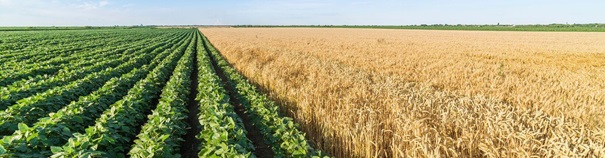
Precision agriculture has transformed the agri-food sector by bringing increased efficiency and resource savings, this technology has become essential for those who want their farm operations optimized from planting planning to harvest. One way to ensure these changes in farming is through the use of fertilizer controls, which intelligently regulate and automate the application of inputs. This type of product makes it possible to apply very finely to each area the ideal amount of fertilizers and correctives, taking into account the characteristics of this point of agricultural production, and not an average dose. This is important because the ground is uneven and growing areas can vary greatly in fertility and chemical requirements. With a controller, the distribution is done judiciously from geo-referenced maps, which are generated from historical productivity and soil analyses. The results of using these technologies are visible.
The new applications developed by the various manufacturers reduce the inputs applied by around 20% and allow a productivity gain of up to 30% in the harvest, since the soil can capture all the nutrients necessary for the development of its crops with quality. . These solutions monitor and control the entire fertilizer application, reducing fertilization failures and deviations, avoiding wasted inputs, and properly equalizing dispersed nutrients in the soil. Application maps previously defined by managers can be imported into these solutions and the operator can control the fertilizer dosage and check the level of the machine’s inlet tank. Calibration is simple and during operation it is possible to view the traces of the application and monitor their coverage in real time.Integration of centimetric precision GPS for guidance
All of these solutions offered by the various manufacturers or integrators embed a precision GPS and receive corrections to refine their position with greater precision. With the advancement of technologies like this, it is possible to use resources more and more intelligently on the ground, ensuring that benefits such as profit and sustainability are possible and contributing to the advancement of a new, even more efficient agro-industry.Accurate GPS and mobile internet connection
Many applications exist today precisely to locate these objects but do not have the precision necessary to take a real advantage. With ± 5m of precision, a classic GPS gives an idea of a position or a route, but when you want to guide a movement to avoid obstacles or you need to know in detail a trajectory, an exact position at an instant t, centimetric precision then becomes indispensable and vital. A precision GPS associated with corrections from the Orpheon network provide the desired centimetric precision.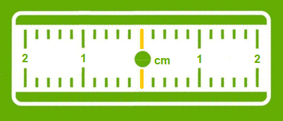
Corrections to gain precision
For its accuracy to be increased and usable in agricultural work, surveying, machine guidance or many other application areas (see) It requires corrections.Precision GPS
We distinguish between two types of GNSS receivers:-
-
-
- Consumer receivers (Watches, phones, tablets, cars etc…) which will only work in natural mode without the possibility of improving their accuracy through corrections
- Precision receivers (RTK), which will be able to integrate external correction data from the Orpheon network allowing them to increase their precision.
-
-