First NRTK FULL GNSS network in France
… the best service, with the highest availability.
Orphéon RTK corrections: Precision in all areas
 Orphéon, the first Full GNSS network in France, offers high-precision geopositioning correction services, increased confidence and productivity to all of its users in many areas such as topography, construction, 3D digitalization, machine guidance, precision agriculture and bathymetry, but also for new applications concerning autonomous vehicles, drones (UAV) and connected objects (IOT and M2M).
Géodata Diffusion continues to develop the quality of its correction services through personalized support, responsive technical assistance and continuous improvement of its infrastructures.
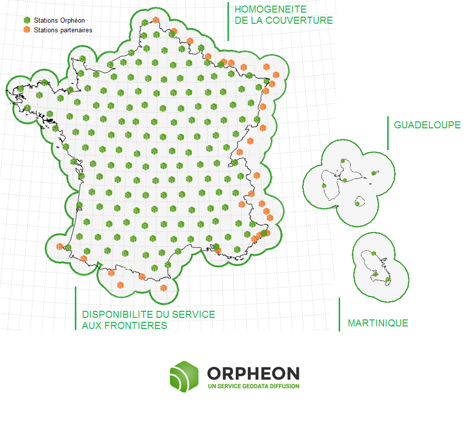
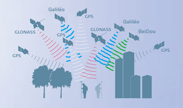
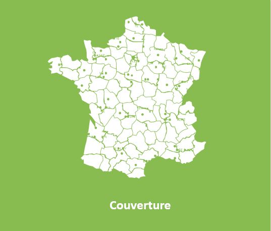
With its 220 stations in France and the Antilles, all Full GNSS: GPS, GLONASS, Galileo and BeiDou with a historic presence in the French Antilles.
Click on the map to access the interactive network map
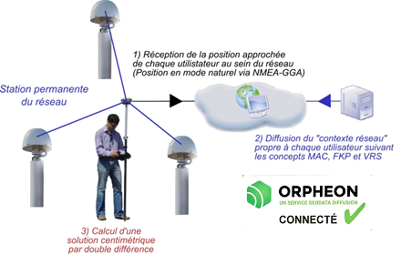
The Orphéon satellite positioning correction system is based on a network of observation reference stations (OSR: Observation Space Representation) distributed over the territory, each position of which is known with precision.
Our objective is to offer customers a secure and innovative service, guaranteeing them a high and constant usage rate wherever they are, throughout the country.
All operations requiring centimeter accuracy are faster, more efficient and more economical. From the preparatory study phases, to the construction or development operations and end-of-construction inspection, everything is optimized.
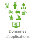
We offer you an overview of the different applications of the Orphéon network.
The precision obtained makes it possible to work in a very large number of professional applications, such as :
- Topography
- Mapping
- Architecture
- Construction, Construction
- Machine guidance
- Construction, inspection of works
- Volume calculation (earthworks)
- Thermometry
- Ortho photography
- Photogrammetry
- Multispectral imaging
- 3D modeling
- Autonomous vehicles
- Bathymetry and maritime works
- Network management or implementation
- Urban heritage management
- Archeology
- Geology
- Oil and energy sector
- Transportation (Rail)
- Environment
- Forest
- Agronomy
- Precision agriculture
- Robotics
- Police work
The Orpheon network in detail :
A very regular presence, without compromise and without equivalent in France.
A regular and homogeneous layout
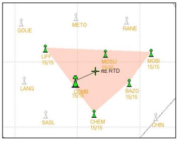
All of our stations form a large balanced and homogeneous GPS network carefully implemented to create a linear and regular geometric mesh and offer uncompromising quality of service with the highest stability.
Territory coverage is uniform wherever you are. With the Orphéon network, you work with identical precision throughout the territory by automatically receiving corrections from a combination of several surrounding stations.
Our strength: positioning accuracy does not depend on the distance to the nearest station or network antenna.
High accuracy and availability
Thanks to its precision and the availability of its real-time GPS RTK corrections, the Orpheon network offers increased productivity to all of its users in the fields of topography, construction, 3D digitization, machine control, precision agriculture and bathymetry, but also for new applications concerning autonomous vehicles, drones (UAV) and connected objects (IOT and M2M).
Géodata Diffusion continues to develop the quality of its services through personalized support, responsive technical assistance and continuous improvement of its infrastructures. Our objective is to offer customers a secure and innovative service, guaranteeing them a high and constant utilization rate wherever they are, throughout the territory.
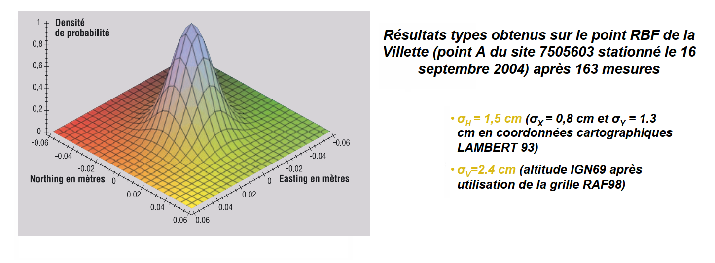
Positioning accuracy with Orphéon is centimetric for a standard deviation of 1σ:
-
-
-
-
- between 1 and 2 centimeters in planimetry (Lambert 93).,
- between 2 and 3 cm in altimetry (IGN69).
-
-
-
The highest availability rate on the market
The strength of the European network is to share infrastructures and the most qualified technical teams to guarantee identical control procedures over the entire coverage area, continuous and regular reinforced monitoring of all stations and the network. This international technical team from a major manufacturer is responsible for supervising all installations 24 hours a day, 365 days a day.
Reinforced coverage
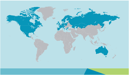
Integration into a large European network
To guarantee a continuous service of constant quality throughout the territory, we share the reference sites within the European network of our Hexagon group.
This European network allows us to integrate additional reference stations and extend the coverage of the Orphéon network for French customers. In this way, even near a border, it is possible to work in a network while being within an RTK cell (and no longer in extrapolated mode).
This coverage is enhanced at borders by sharing reference stations from our international Hxgn SmartNet network with:
- Belgium
- Luxembourg
- Germany
- Switzerland
- Italy
- Spain
International expertise covering many countries
By integrating the Hexagon Group in 2014, the Orphéon network joined a vast network of reference stations within the first operational European NRTK network covering many countries.
On the strength of its international experience and its expertise in real-time positioning, the Hexagon group, within its various companies, intends to offer the most uniform and extensive real-time positioning service with centimetric precision.
International technical support at your service
This secure infrastructure, set up and managed by the Hexagon group, allows the pooling of technical support resources within the group for all the countries whose management is centralized.
This organization also makes it possible to offer a service available 24/7 and to offer one of the highest availability rates on the market.

